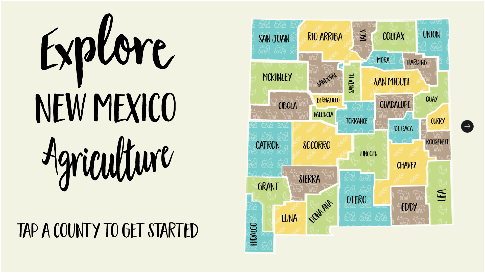
Communication and outreach to farmers and ranchers is a key component of Natural Resources Conservation Service (NRCS) in New Mexico efforts. To assist in these efforts, NRCS NM purchased an Ideum touch table and had a custom offline application developed to showcase the services offered by the organization. Over time, the content became static, and […]
Electric Cooperatives
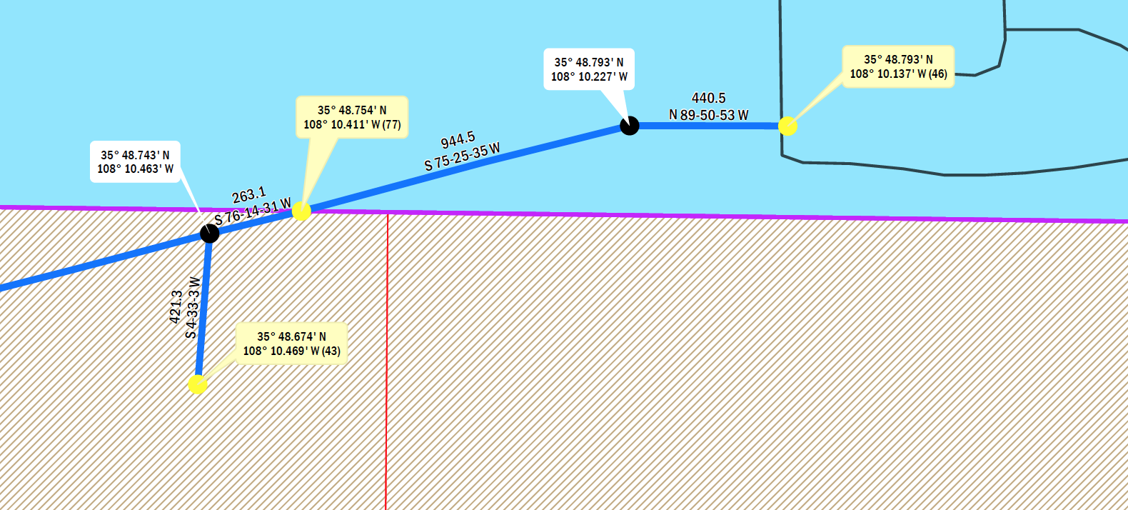
Continental Divide Electric Cooperative (CDEC) is an electric cooperative in New Mexico that provides electricity across a large stretch of the northwestern part of the state. Electric Cooperatives like the CDEC are responsible for maintaining several assets over large areas of land with complicated easement agreements. Having a map of these assets and accurate documentation […]
Clayton Lake Dinosaur Track Project
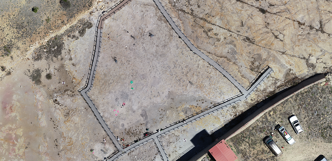
The Clayton Lake Dinosaur Tracks Project (CLDTP) project was a one week collaboration between Central New Mexico Community College (CNM), NM Natural History Museum, and NM State Parks. The team cleaned, mapped, and built three-dimensional models of the dinosaur tracks using aerial and terrestrial photogrammetry. Smallmelo’s Melo King participated in the event as a student […]
Verde
Almeria Analytics is a New Mexico company that received NOAA Small Business Innovative Research (SBIR) funding. We were subcontracted in Phase II to develop Verde — a suite of emergency preparedness tools with scientists and engineers from Oak Ridge National Lab and the University of Tennessee. Custom Development Verde was designed to allows its […]
Maps for Golf & Disc Golf Courses
In 2016, we were hired by a superintendent new to a Golf & Disc Golf Course that wanted to utilize our expertise in transitioning and maintaining their assets. In total, they were responsible for managing 18 disc golf and 27 golf holes. Data Collection We used high accuracy GPS and a collector to capture: Location, […]
Residential Plant Maps
Being a new homeowner is an exciting and daunting role. One way we’ve found that helps new home owners settle into their homes is to spend time in their yards mapping out the existing plants and using a blank minimalist map to help plan future projects. Cartography & Mapping These blank minimalist maps are intended […]
Find My School
A public school district’s timely and relevant communication to parents and the community is essential. Sharing information often requires information sharing between departments that don’t often need to interact otherwise. In 2016, we had the honor of working with the Albuquerque Public Schools (APS) web team to build a web tool for the public that […]
Pre-Excavation Mapping

‘The Northern Solution’ is a portion of the Town of Snowflake’s Drainage Master Plan. We were approached by the Town of Snowflake to map the area with UAV technology before excavation began on site. Using photogrammetry on the photos taken from the air, we generated multiple data products including aerial imagery, a digital elevation model, […]
The Upload Tool
The New Mexico Forestry & Watershed Restoration Institute (NMFWRI) provides technical assistance and practical knowledge in forest restoration throughout the state of New Mexico. Custom Development NMFWRI brought us on board to design and develop the “Upload Tool,” which gives federal, state, and private entities the means to contribute their vegetation treatments to a state-wide […]
Supporting Small Water Systems
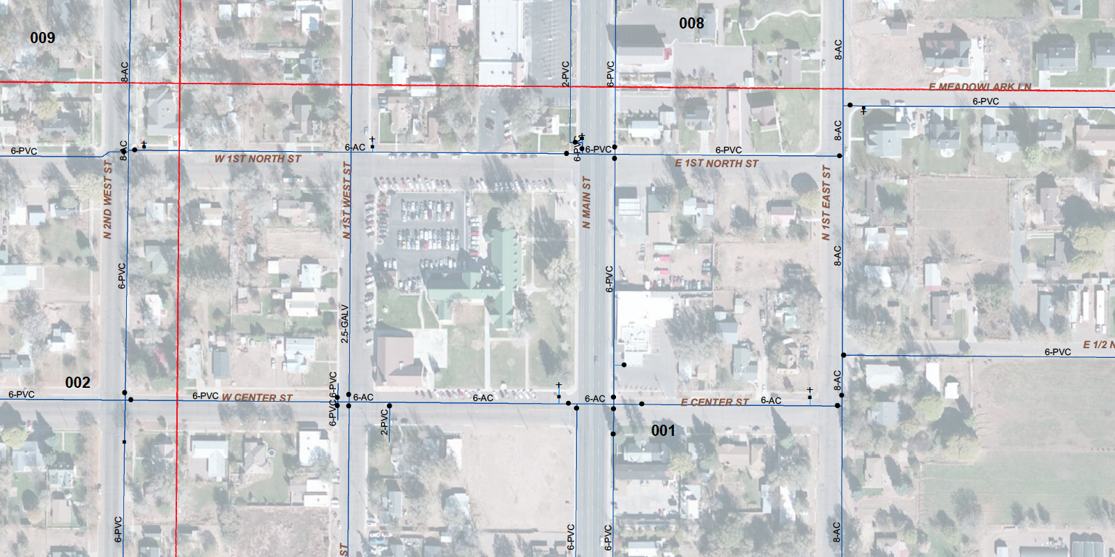
Water masters are overworked and under-appreciated. Having a geographic information system (GIS) of your delivery system helps ensure sustainability of the system long term, and gives your water master a chance to retire.
Map-based Cemetery Management
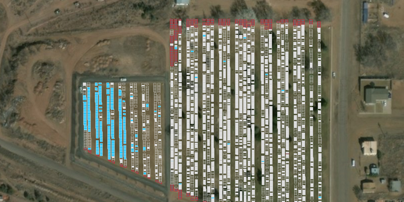
The Town of Taylor’s cemetery has been managed by the same person for decades and they were ready to retire. We were asked to help them move to a new map-based system that would be easier for someone else to take over.
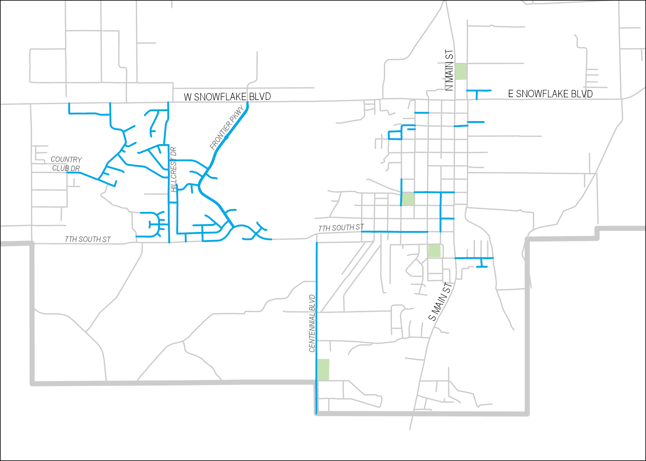
Maps in Master Plans
Master Plans play a key role in the sustainability and growth of communities. They are used to articulate current and future infrastructure needs, lay out maintenance plans, reduce/eliminate flooding conditions, and predict economic growth. Our long-standing relationship with the Town of Snowflake has given us several opportunities to contribute maps to an assortment of master […]
Assessing Pavement Conditions
Pavement Inspector is an Android application built in collaboration with the Town of Snowflake’s Engineer and Public Works Director. The app walks users through a form for scoring the condition of a pavement segment according to several distress categories (on a scale of 1 to 5). It also asks users to give ridability and weathering […]
Fuels Mesaure Data Portal

Field Measures is a New Mexico company that develops productivity apps for field scientists. We were hired by Field Measures to build a web-based data portal to accompany the Fuels Measure mobile app — a mobile app designed to streamline the collection of data used to quantify forest fire potential for an area of interest. […]
Whale mAPP
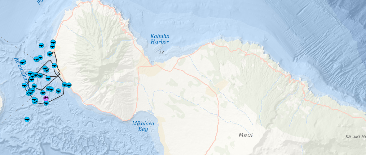
Whale mAPP is a collection of GIS-based web and mobile tools used by researchers and citizen scientists to contribute observations for scientists studying and mapping human impact on marine mammals. It was born out of the University of Redlands by Dr. Lei Lani Stelle and was initially designed and built by Smallmelo’s Melo King as […]