The Clayton Lake Dinosaur Tracks Project (CLDTP) project was a one week collaboration between Central New Mexico Community College (CNM), NM Natural History Museum, and NM State Parks. The team cleaned, mapped, and built three-dimensional models of the dinosaur tracks using aerial and terrestrial photogrammetry. Smallmelo’s Melo King participated in the event as a student […]
Data Collection
Learn more about how we collect data
Maps for Golf & Disc Golf Courses
In 2016, we were hired by a superintendent new to a Golf & Disc Golf Course that wanted to utilize our expertise in transitioning and maintaining their assets. In total, they were responsible for managing 18 disc golf and 27 golf holes. Data Collection We used high accuracy GPS and a collector to capture: Location, […]
Residential Plant Maps
Being a new homeowner is an exciting and daunting role. One way we’ve found that helps new home owners settle into their homes is to spend time in their yards mapping out the existing plants and using a blank minimalist map to help plan future projects. Cartography & Mapping These blank minimalist maps are intended […]
Pre-Excavation Mapping
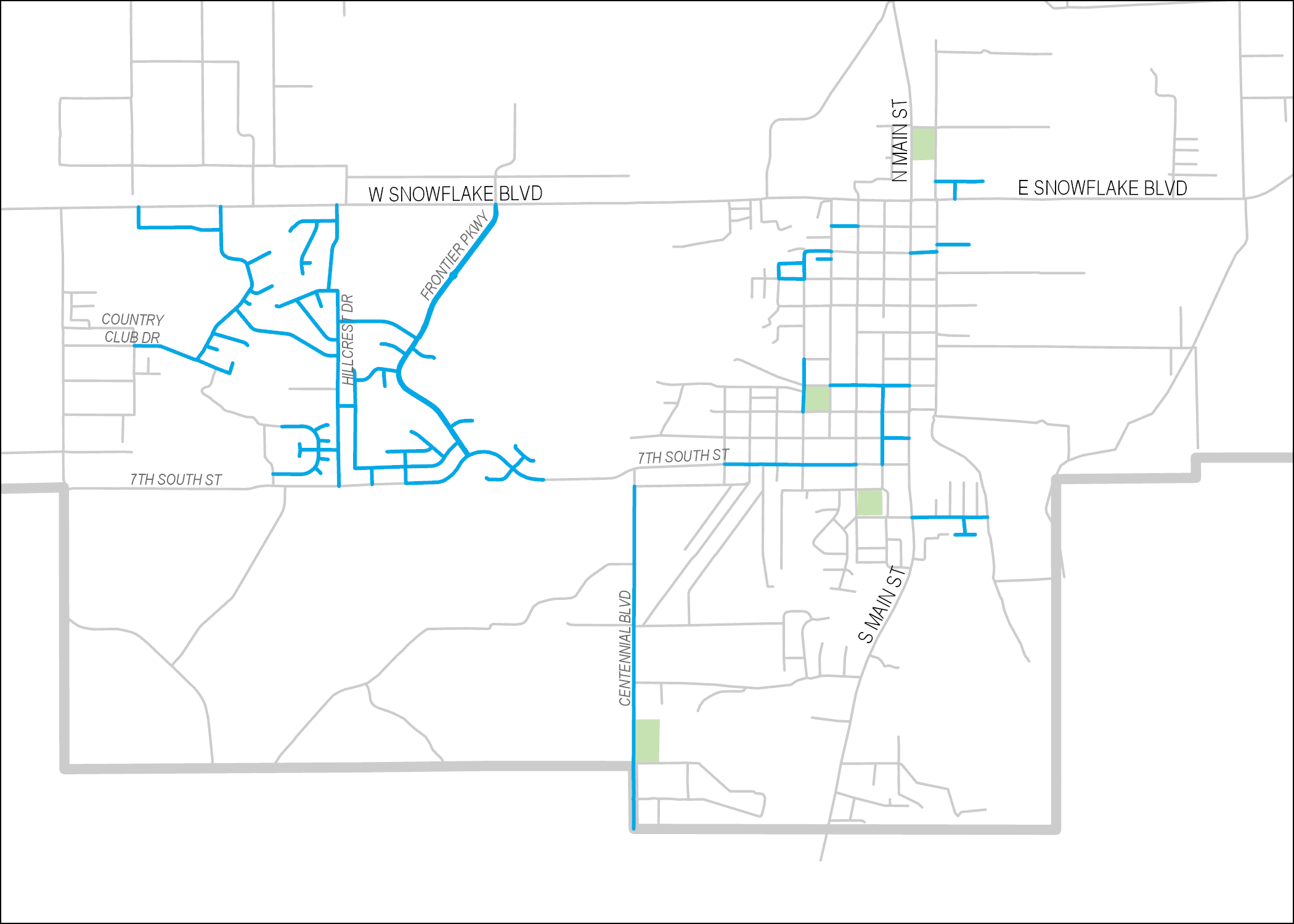
‘The Northern Solution’ is a portion of the Town of Snowflake’s Drainage Master Plan. We were approached by the Town of Snowflake to map the area with UAV technology before excavation began on site. Using photogrammetry on the photos taken from the air, we generated multiple data products including aerial imagery, a digital elevation model, […]
Supporting Small Water Systems
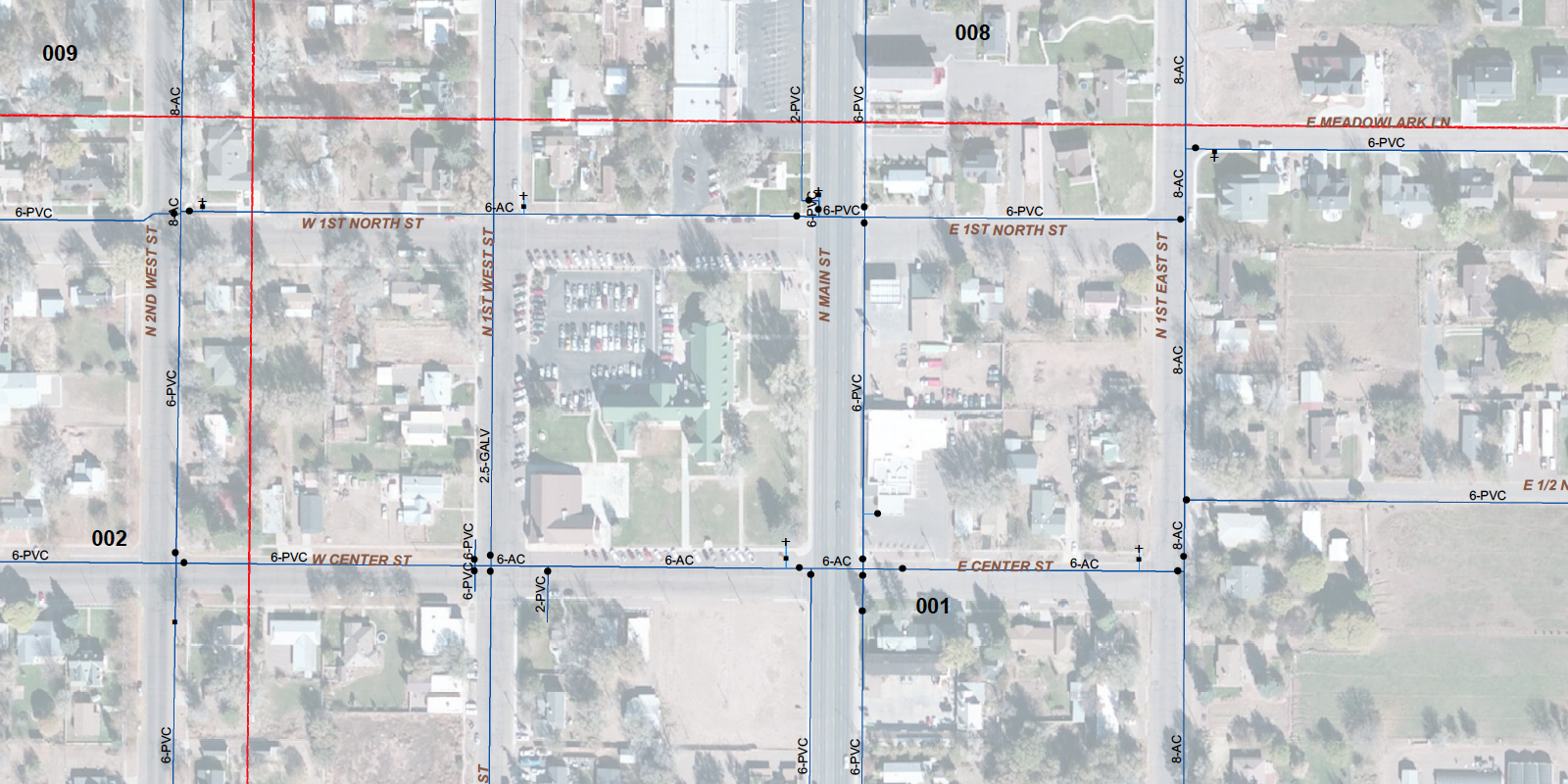
Water masters are overworked and under-appreciated. Having a geographic information system (GIS) of your delivery system helps ensure sustainability of the system long term, and gives your water master a chance to retire.
Assessing Pavement Conditions
Pavement Inspector is an Android application built in collaboration with the Town of Snowflake’s Engineer and Public Works Director. The app walks users through a form for scoring the condition of a pavement segment according to several distress categories (on a scale of 1 to 5). It also asks users to give ridability and weathering […]